
Fairy Meadows Pakistan: The Complete Guide for First-Time Visitors (Is It Worth It?)
Fairy Meadows is the place that comes with a genuinely intense jeep ride, a real trek, and a cost structure that surprises people who assumed "meadow" meant "easy." Here's what actually happens between booking this and standing in that photo.
The Quick Guide (At a Glance)
- 01/ Location & altitude: Raikot Valley, Diamer District, Gilgit-Baltistan — roughly 3,300 m (10,800 ft), reached via Raikot Bridge on the Karakoram Highway, about 2 hours from Gilgit city.
- 02/ Getting there: A local jeep (driven only by licensed area residents) from Raikot Bridge to Tattu village, then a forest trek of roughly 5 km that takes most people 2–4 hours.
- 03/ Difficulty: Moderate, not technical — steep in sections but manageable for most reasonably fit travelers; horses are available at Tattu for those who'd rather not walk.
- 04/ Best time to visit:Roughly June to September for reliable access; the route is snowed in outside this window, and some shoulder weeks are noticeably quieter than peak domestic holiday periods.
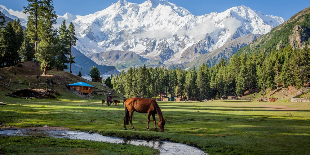
If you've spent any time looking into Pakistan's north, you've already seen the photo: a green alpine meadow, a scattering of wooden huts, and behind it all, Nanga Parbat rising straight out of the grass like it's not even trying to be subtle about it. That photo is real, and it's the reason Fairy Meadows has gone from a niche mountaineering waypoint to arguably the most-asked-about destination in Gilgit-Baltistan.
What You're Actually Signing Up For
Is Fairy Meadows Worth It? Short answer: yes, for most travelers who make it to northern
Pakistan at all — but it's worth being honest about what kind of trip this is before you book
it. The draw is genuinely rare: a close, unobstructed view of an 8,000-metre peak that doesn't
require a multi-day expedition or technical climbing experience to reach. Very few places on
earth let you stand this close to a mountain of that scale after a single day's travel and a few
hours on foot.
What it isn't is a relaxing weekend getaway. Everything at Fairy Meadows — food, fuel, building
materials — has to be carried up by porter or jeep, which makes meals and guesthouse stays
noticeably more expensive than what you'd pay just a few hours away in Gilgit or Hunza. The jeep
ride has a fearsome reputation, deservedly. And depending on when you go, you may be sharing the
meadow with a large wave of domestic tourists rather than a handful of fellow trekkers. None of
that cancels out the experience, but if you're picturing solitude and budget camping,
recalibrate — Fairy Meadows rewards people who come prepared for a logistically demanding,
moderately pricey trip in exchange for one of the best mountain views in the country.
"To travel is to discover that everyone is wrong about other countries"
— Aldous Huxley
The Jeep Ride, the Trek, and What It Actually Costs
Getting here happens in stages, and each one is worth planning for separately. Most travelers
start by reaching Gilgit — by air from Islamabad (weather-dependent and prone to cancellation in
poor visibility) or by a long overland journey on the Karakoram Highway. From Gilgit, it's about
a 2-hour drive to Raikot Bridge, where the paved road effectively ends.
From Raikot Bridge, the only way up is by local jeep, driven exclusively by licensed area
residents — this isn't a rule you can work around even with your own 4x4. The jeep track to
Tattu village runs roughly 14–15 km and takes anywhere from 1.5 to 2.5 hours, depending on
conditions and how many landslide repairs are in progress (these are a seasonal reality on this
route, especially after heavy rain in July and August). Round-trip jeep fares have generally run
in the 17,000–22,500 PKR range in recent seasons, split between however many passengers fit
(officially up to five or six, more comfortably four with luggage); solo travelers sometimes
wait at the bridge hoping to share a jeep, though this can cost you time you'd rather spend on
the trail.
From Tattu (sometimes called Fairy Point), it's on foot — or on a rented horse —
for the final stretch: around 5 km of forest trail gaining roughly 700 metres of elevation to
reach the meadow itself. Budget two to four hours depending on pace, heat, and how much luggage
you're carrying (hiring a porter for bags is common and worth it if you're not traveling light).
All told, plan on covering transportation, jeep fare, food, and a guesthouse or camping fee —
most independent travelers report all-in costs somewhere in the PKR 20,000–35,000 per person
range for the full round trip, food and lodging included.
How Hard Is the Walk, Really?
This is the question that talks people out of going when it shouldn't, so it's worth being
specific. The walk from Tattu to Fairy Meadows is a forest trail — well-used, clearly marked,
and not technical in any sense: no ropes, no exposed scrambling, no specialized gear. What makes
it feel harder than the distance suggests is the altitude (you're climbing from roughly 2,600 m
to 3,300 m) and, if you're unlucky with timing, direct sun on an exposed stretch before the
trail enters tree cover. Reasonably fit adults typically manage it in two to three hours; less
experienced or unacclimatized hikers, or anyone carrying a full pack, should expect closer to
four.
It's genuinely manageable for older teens and capable kids (most operators consider it suitable
from around age ten up), and renting a horse at Tattu is a legitimate option if walking uphill
at altitude isn't something you want to do — locals use them regularly, not just as a tourist
novelty. The bigger physical challenge for most visitors isn't the Fairy Meadows trail itself
but the jeep ride that precedes it, which is bumpier and more nerve-jangling than anything
you'll encounter on foot.
The Nanga Parbat Base Camp Hike
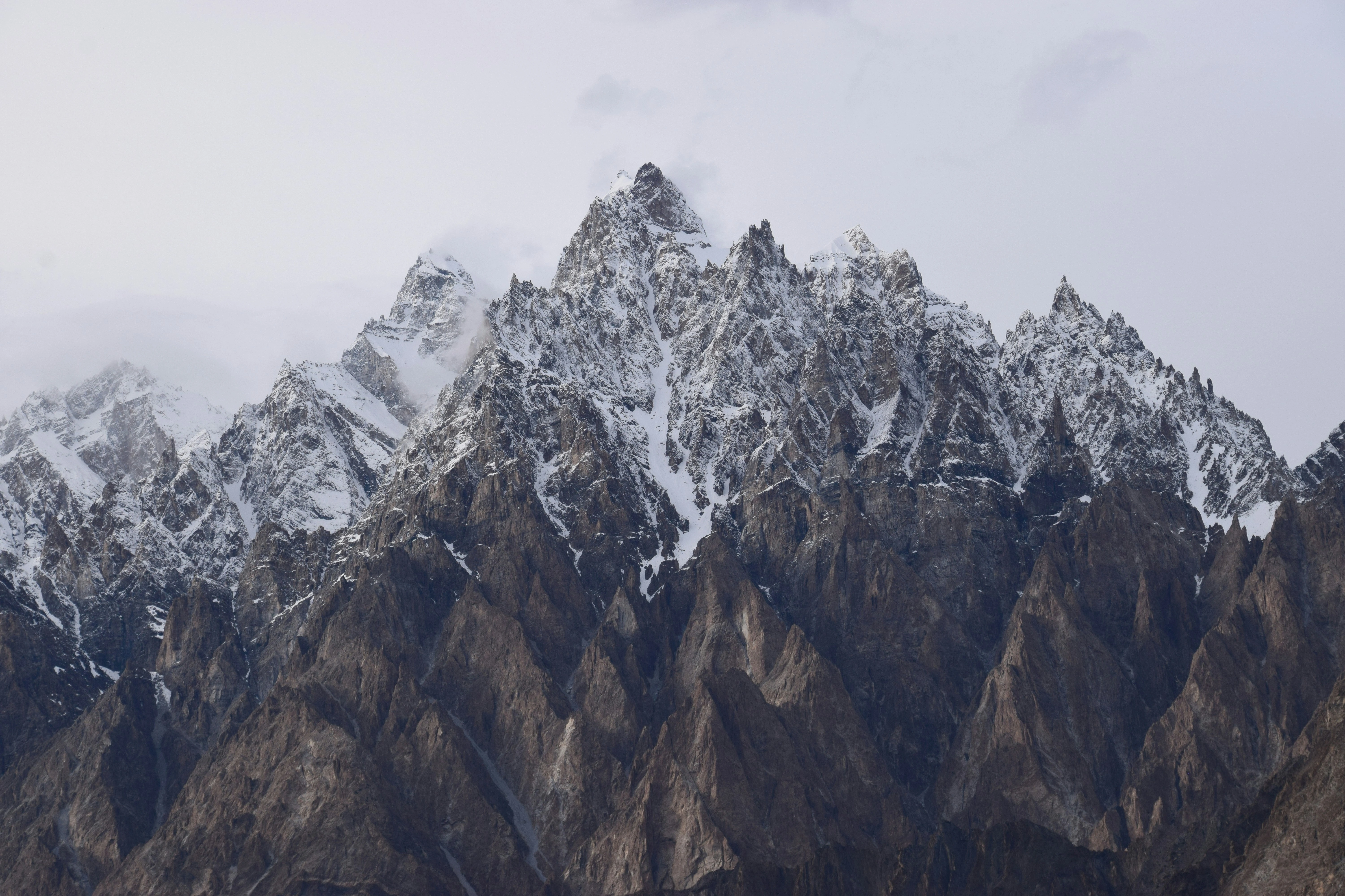
Most people don't stop at the meadow itself. A day hike from Fairy Meadows toward Nanga Parbat's
base camp area is the natural next step, and it's the part of the trip that turns "nice view"
into "I was standing next to an 8,000-metre mountain." The hike runs along a relatively gentle
ridge trail for several hours, passing the Raikot Glacier and opening onto progressively closer
views of Nanga Parbat's north face, with many itineraries reaching a viewpoint or the Bayal Camp
area in around three to four hours one-way before returning to Fairy Meadows the same day. It's
graded easy-to-moderate by most local operators — no technical climbing — but it is a full day
out, so start early, especially if you want clear morning visibility before afternoon clouds
tend to build up around the peak.
One persistent piece of traveler lore worth a reality
check: the Raikot jeep road is frequently described online as "the second most dangerous road in
the world," often attributed to a 2013 WHO report. Several experienced travel writers who've
gone looking for that report haven't been able to track down the original source, which suggests
this is more internet legend than verified statistic. That doesn't make the road any less
intense to ride — it's narrow, exposed, and not for the faint of heart — but it's worth knowing
the famous statistic behind it may not actually exist.
Best Time, Permits, and Practical Tips for Foreigners
The practical season for Fairy Meadows runs roughly April through November, with June through
September being the most reliable window — outside that, snow closes the route entirely. Within
the open season, timing still matters: domestic tourism spikes hard around Pakistani public
holidays and school break periods, and a meadow that feels serene on a regular weekday in June
can feel considerably busier during peak weeks.
On paperwork: no NOC (No Objection
Certificate) is currently required for foreigners to visit Fairy Meadows, since it's managed as
a national park rather than a restricted zone, and the police escort that was once routinely
assigned to foreign visitors at Raikot Bridge has reportedly been dropped in recent seasons.
That said, Gilgit-Baltistan's local rules have changed before with little notice, so it's worth
confirming current requirements with your operator or hotel shortly before you travel rather
than assuming last year's rules still apply. A few other practicalities worth packing around:
mobile coverage near Raikot and at the meadow is limited to the SCOM network (Jazz, Telenor, and
Zong generally lose signal here), there are no ATMs past Chilas or Gilgit so bring enough cash
for the whole trip, and the nearest hospital is back in Chilas or Gilgit, which is worth
factoring into how you think about altitude and any pre-existing health considerations before
you commit to the trek.
Frequently Asked Questions
For most travelers who make it to northern Pakistan, yes — it offers an unusually close, unobstructed view of Nanga Parbat without a technical climb or multi-day expedition. The trade-offs are real, though: a genuinely intense jeep ride, higher food and lodging costs than elsewhere in the region (everything is carried up by porter), and crowds during peak domestic holiday periods.
From Islamabad, most travelers fly or drive to Gilgit first, then take a roughly 2-hour drive to Raikot Bridge on the Karakoram Highway. From there, a local jeep (driven only by licensed residents) covers the rough 14–15 km track to Tattu village in 1.5–2.5 hours, followed by a 5 km forest trek of 2–4 hours on foot to reach the meadow itself.
It's a non-technical forest trail, manageable for most reasonably fit adults in two to three hours, with the altitude gain (roughly 2,600 m to 3,300 m) being the main challenge rather than the terrain itself. Horses are available at Tattu for anyone who'd rather not walk, and it's generally considered suitable for capable kids around age ten and up.
No NOC is currently required, since the area is managed as a national park rather than a restricted zone, and the police escort once assigned to foreign visitors at Raikot Bridge has reportedly been discontinued in recent seasons. Rules in Gilgit-Baltistan can change without much notice, though, so confirm current requirements with your operator close to your travel date.
June through September is the most reliable window, when the route is consistently clear of snow. The broader season can stretch from April to November depending on conditions, but anything outside the June–September core carries a higher chance of the access road being closed.