
Hunza Valley Travel Guide for Foreign Visitors (2026)
Hunza is the destination that makes people change their Pakistan plans midway through researching it. They arrive looking for one week and leave wondering how to come back for a month. Here is the practical version of why.
The Quick Guide (At a Glance)
- 01/ Location: Hunza Valley sits in Gilgit-Baltistan, roughly 600 km from Islamabad by road or a 45-minute flight to Gilgit followed by 2 to 2.5 hours by car to Karimabad — the valley's main town.
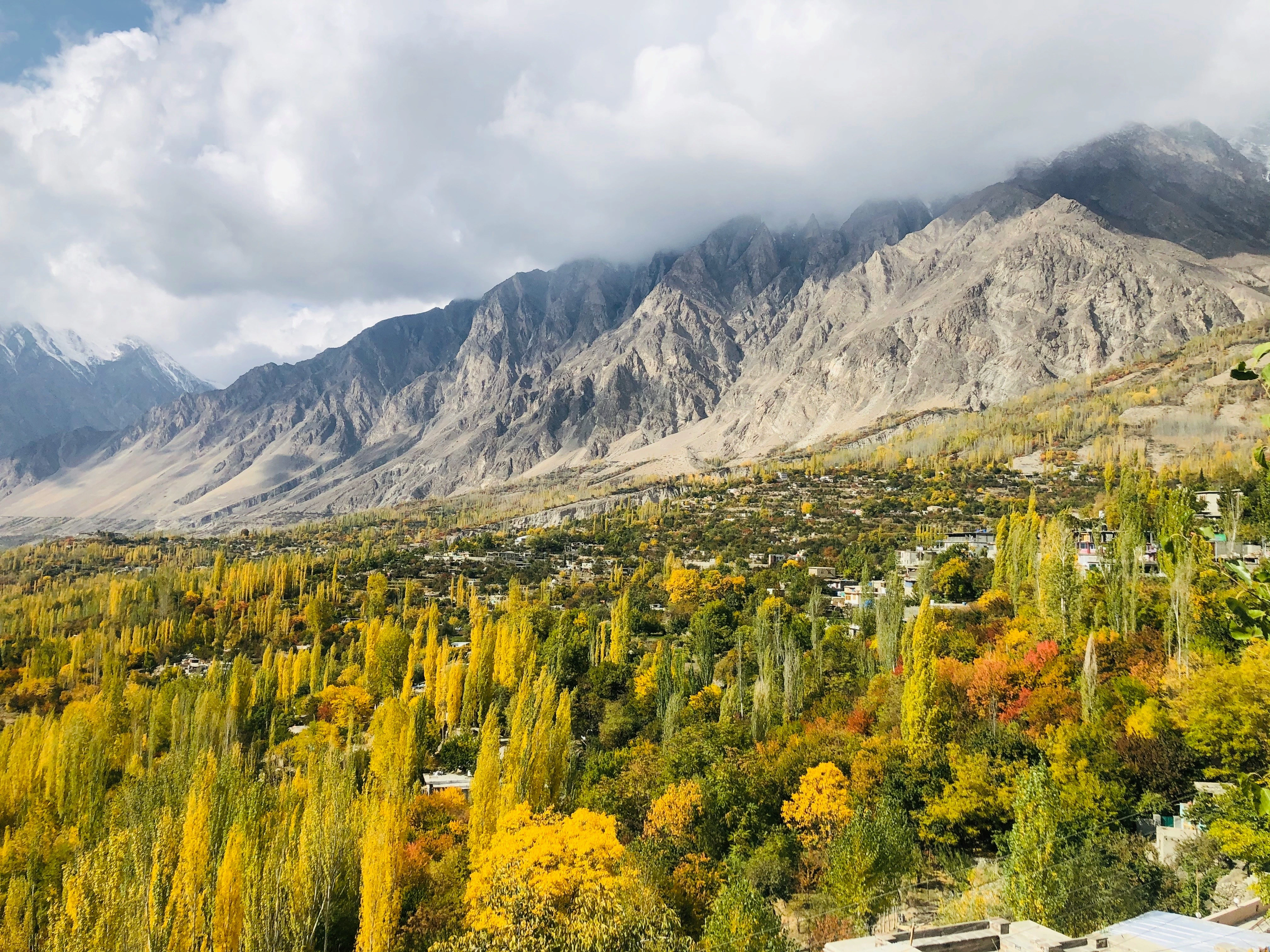
- 02/ What it is: A high mountain valley at around 2,438 m elevation, surrounded by peaks above 7,000 m, with a distinct Burusho culture, ancient forts, terraced apricot orchards, and some of the most dramatic views available without technical climbing.
- 03/ How long to visit: Three to four days covers the main Lower Hunza sights; five to seven adds Upper Hunza including Attabad Lake and Passu. Eight or more days opens the remote side valleys.
- 04/ Safety: Hunza is one of the most consistently safe areas in Pakistan for international visitors and is not covered by any Western government "do not travel" advisory.
Getting to Hunza: Flights, the KKH, and Why the Journey Is Part of It
Most international visitors reach Hunza via one of two routes, and each has a different
character.
The faster option is flying from Islamabad to Gilgit on Pakistan International Airlines or a
domestic carrier. The flight takes around 45 minutes and the mountain views are
extraordinary — pilots navigate through peaks rather than over them, and on a clear day you
can see Nanga Parbat from the window. The catch is reliability: Gilgit flights are highly
weather-dependent and cancellations are frequent, sometimes for multiple consecutive days. If
you're flying, build slack into your itinerary and do not rely on a fixed same-day
connection.
The overland option via the Karakoram Highway is the slower but more dependable route.
Islamabad to Karimabad covers approximately 600 km, takes between 12 and 16 hours depending on
road conditions and stops, and passes through Abbottabad, Mansehra, Besham, Chilas, and Gilgit
before climbing into the valley. Most independent travellers break the journey overnight in
Chilas or Gilgit. There is also a seasonal alternative via Naran and Babusar Top (open
roughly June to October) that adds hours but considerably more alpine scenery.
From Gilgit city, Karimabad is 2 to 2.5 hours by road. This is also the staging point for
Fairy Meadows — see our
complete Fairy Meadows
guide if you're combining both destinations, which most visitors do.
A practical note: ATMs in Karimabad are unreliable at peak season and frequently run out of
cash. Withdraw enough Pakistani rupees in Gilgit or Islamabad to cover your full Hunza stay
before heading up.
Karimabad and Lower Hunza — Baltit Fort, Altit Fort, and Eagle's Nest
Karimabad is where most visitors base themselves — a small town at around 2,438 m with direct
sightlines to Ultar Sar, Rakaposhi (7,788 m), and Ladyfinger Peak. It has a concentrated range
of guesthouses and hotels across all price points, a bazaar worth spending an afternoon in,
and the two forts that define the valley.
Baltit Fort sits directly above Karimabad on a rocky spur and has been the seat of the Mirs
who ruled Hunza for centuries. It has been carefully restored and the interior walk gives a
genuine sense of the valley's political history. The views from the fort's upper levels —
looking down across the terraced orchards to the valley floor and up to the encircling peaks
— are among the best in the region without any hiking involved. Entry fee for foreigners is
currently around PKR 1,600 to 1,650; open daily with slightly reduced hours in winter.
Altit Fort, 5 km down the valley in Altit village, is older than Baltit by several centuries
and typically quieter. The restoration is excellent and the gardens below the fort are worth
the extra visit. Entry for foreigners is approximately PKR 1,650. Most visitors do both forts
on the same day.
Eagle's Nest viewpoint sits above Karimabad at roughly 3,100 m and is the standard half-day
hike — around 2 to 3 hours up on foot from the town centre. From the top, on a clear day, you
can see Rakaposhi, Ultar Sar, Ladyfinger Peak, Diran, and Golden Peak simultaneously. Go early
morning for the best visibility before afternoon haze builds. There is a guesthouse and
restaurant at the top if you want to stay overnight for sunrise.
Upper Hunza — Attabad Lake, Passu, and the Hussaini Bridge
Attabad Lake is approximately 20 to 25 km north of Karimabad and is among the most
photographed locations in Pakistan. It was created in January 2010 when a massive landslide
dammed the Hunza River, submerging villages and forming a 21 km long turquoise lake that now
extends into the cliff-lined gorge above. The colour of the water — an intense glacial
turquoise — is real and not camera-enhanced. Boat rides are available on the lake; the KKH
passes through five tunnels cut through the cliff above it, which were built to replace the
section of road swallowed by the flood. Drive from Karimabad takes 30 to 40 minutes.
Beyond Attabad, the valley opens into Gojal — Upper Hunza — and the landscape becomes more
austere and dramatically vertical. Passu, roughly 50 km from Karimabad, is the base for
viewing the Passu Cones: a cluster of cathedral-like rock spires that have become one of
Pakistan's most recognisable mountain images. The Hussaini Suspension Bridge nearby is one of
the more intact examples of the traditional rope bridges of northern Pakistan and worth the
short detour.
Borith Lake, a smaller glacial lake above Passu, is a good half-day walk from the village. The
Passu Glacier itself is accessible via a short trail and gives a close-up of the ice that
feeds the valley's rivers. For travellers with more time, the Shimshal Valley — one of
Pakistan's most remote and least-visited side valleys — branches east from Passu and is
accessible by a rough road.
Khunjerab Pass, the world's highest paved international border crossing at 4,693 m, is a
further 85 km north of Passu through Sost. Our
Khunjerab Pass guide covers it in full — most Hunza
visitors do it as a long day trip rather than an overnight.
What to Know About Hunza Before You Go
Hunza's Burusho community — the dominant ethnic group in the valley — has one of the highest
literacy rates in Pakistan and a long history of relatively open cultural exchange with
outsiders. Women are considerably more visible in public life than in much of the rest of the
country, English is widely spoken in tourist-facing businesses, and solo female travellers
consistently report Hunza as one of the most comfortable destinations in Pakistan. Modest
dress is still expected and appreciated, but the atmosphere is noticeably more relaxed than
elsewhere.
Food in Hunza has a character distinct from the rest of Pakistan — closer to Central Asian
cuisine than South Asian. The valley is famous for its apricots (both fresh and dried),
walnut products, local bread, and a range of dishes made with buckwheat. Chapshuro — a flat
bread filled with meat and vegetables — is the dish most worth ordering. Hunza tea (locally
called noon chai, made with salt and milk) is an acquired taste but worth trying. Most cafes
and guesthouses in Karimabad also serve standard Pakistani dishes and Western options.
Jazz has reliable signal in Karimabad and most of Lower Hunza; coverage gets patchier in
Upper Hunza and drops out beyond Passu toward the Chinese border. SCOM is the only network
with coverage at Khunjerab Pass.
Best seasons in summary: late April to early June (blossom season, the most dramatic visual
spectacle), September to October (clear skies, cooler temperatures, autumn colours,
harvests). Peak crowds hit in July and August, and availability at popular guesthouses gets
tight. Winter between November and March sees some of the higher passes close but Karimabad
remains accessible and almost entirely tourist-free.
If you want Hunza built into a broader Gilgit-Baltistan itinerary alongside Skardu, Fairy
Meadows, and the Karakoram Highway, our
Gilgit-Baltistan
Immersive Tour sequences these destinations in the order that makes practical and
altitude-acclimatisation sense.
Frequently Asked Questions
By air, fly from Islamabad to Gilgit (around 45 minutes, weather-dependent and prone to cancellation in poor visibility), then drive approximately 2 to 2.5 hours to Karimabad. By road, the full KKH drive from Islamabad to Karimabad covers roughly 600 km and takes 12 to 16 hours depending on road conditions and stops.
Three to four days covers the core of Lower Hunza: Baltit Fort, Altit Fort, Eagle's Nest, and Karimabad. Five to seven days allows you to add Upper Hunza — Attabad Lake, Passu, and the Hussaini Bridge. Eight or more opens the remote side valleys. If combining with Fairy Meadows or Skardu, factor in travel days along the KKH.
Yes. Hunza is consistently one of the most safe regions in Pakistan for international visitors and is not covered by any Western government "do not travel" advisory. Gilgit-Baltistan has a meaningfully different security profile from Khyber Pakhtunkhwa. Foreign visitors including solo female travellers report feeling safe and genuinely welcomed throughout the valley.
Late April to early June for blossom season. September and October for clear skies, cooler temperatures, and harvest season. July and August are the most crowded months. Winter is dramatically quiet but closes higher routes.
No permit or NOC is required to visit Hunza or main areas of Lower and Upper Hunza. Carry your passport at all times for KKH checkpoints. Some restricted areas further north toward the Chinese border have separate requirements.